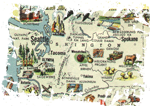
Very cool: an early 1950’s pictoral map of the United States of America, apparently issued by the US Government to introduce our country to the people of Germany, most of whom knew little of us outside of what they’d picked up from GIs in their country during World War II.
Relevant commentary from the MetaFilter thread where I found this:
So the State Dept. handed out these maps to give Germans some idea of what the US looked like? I’m interested in their intentions, and the history behind this map give-away.
well, smackfu suggests that the map is from around 1951. There was only a vague image of the United States in Germany then.
For many Germans Americans were huge, well-fed guys handing out chewing gums to German post-war kids. And some of these guys even were black. (I remember my grandmother telling me how amazed she was when she saw the first black G.I., the first black person she ever saw.) Now imagine what people must have thought of the United States then. Of course they knew about cowboys, the Liberty Statue and so on but that was about it.
I think the map was supposed to give a somewhat more detailed look an the United States, but then again not too sophisticated. The Secretary of State probably imagined that Germans would be overwhelmed otherwise. Maybe they really would have been. I assume that’s why it’s designed like a children’s map.
Then again, in the early fifties Germans started to go on holiday again. So it might be a promotional map for the American tourist industry.
That’s what I can think of.
— heimchen
Check out the full-size (7 Mb) map here.
