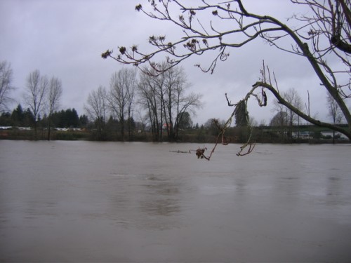
First off, the good news: we’re not being affected by the current weather craziness hitting the northwest. While we’re near the Green River, which is pretty high at the moment — the National Weather Service Advanced Hydrologic Prediction Service has one checkpoint on the Green River, near Aburn (just south of us), which shows it at ‘Action Stage’ but already crested and predicted to drop (check other NW area rivers here — it doesn’t look like it’ll be flooding in our area.
That said, this is nuts! This stormpocalypse hit us in two stages: first the snowpocalypse, and now the floodpocalypse (yes, the nomenclature is silly, but that’s part of the fun). I’ve been watching #waflood on Twitter, and it’s been fascinating watching all the updates appear.
It’s also neat seeing just who all is involved with this method of awareness and communication. In addition to all the “normal people” giving updates, the Washington State Department of Transportation is using WSDOT and @terpening (as well as their Flickr account, the city of Bellingham, FEMA (a far cry from Katrina!), the Red Cross, King County, and probably plenty of other official organizations are joining in. Lots of good information coming out…even when the information isn’t good:
Washington Transportation Secretary Paula
Hammond says Interstate 5 at Chehalis could be closed for four
days.The Transportation Department is monitoring the flooding. The DOT says I-5 is closed from US 12, milepost 68, to Grand Mound, milepost 88 in Lewis County due to the rising water in Dillenbaugh Creek south of Chehalis.
Hammond says the flooding is similar to the December 2007 flood that caused a four-day blockage on the main north-south route in Western Washington.
Hammond says when the Chehalis River crests Thursday night,
officials expect water to be 10 feet deep over the highway. After
the water starts falling, crews plan to use pumps and breach a levy
to help the water drain out.Hammond says about 10,000 trucks a day travel I-5 and the
financial impact of the closure on freight movement is about $4
million a day. That’s made worse by the closure of the three major
Cascade passes.
In fact, according to an early morning WSDOT tweet, “There are no north south routes available between Seattle and Portland, or east west routes from Western WA to Spokane at this time #waflood”. Unless you want to go to Canada, Seattle and its surrounding metro area is essentially completely cut off!
Crazy stuff, and I’m counting myself quite glad to not be directly impacted by any of this — though it came close, as Prairie’s dad sent us a shot of the Lewis River just outside his house in Woodland (in southern Washington, just north of Vancouver, which is just north of Portland).
The river holding, the rising has slowed, four feet to the top of the bank, then four feet to the main floor. Am watching close, a fireman rang the door bell, said be ready to evacuate, have been planning but have taken no action, hope that I don’t have to scramble.
It sounds like the river didn’t get quite high enough for evacuation, but that’s pretty close!
So…what’s going to be Stormpocalypse Part III?
