
A brief note to begin with: I’ll be including a few iPhone photos here and there, but most of my photography for this trip is being done with my “real” camera. And since I want to focus on enjoying the vacation and not processing photos, those will be waiting until some time after we get home before they make it online. Until then, enjoy what’s here and use your imagination. :)
Day 1: Seattle to San Francisco
This was originally planned to be an overnight train trip on Amtrak’s Coast Starlight run, but when an abandoned building burned and was deemed so unstable that it could collapse onto the tracks at any moment, Amtrak cancelled all runs between Seattle and Portland. So, we fly instead!
TSA at SeaTac was fine, and we breezed right through. Found our gate, got some lunch, and settled in to wait to board.

First time flying first class. Not bad at all!
Got to SFO; looks like a nice airport. Started finding out way to the BART station, got on the airport train…and got right back off again — once they manually opened the doors — when it broke down. At least it was still mobile, so it pulled away and another appeared. Got on the BART and went the wrong way, but it was only one stop and then this line reverses to go the other direction, so it was only a minor detour. Taking the scenic route?

Got to the hotel (quite a walk with these backpacks), dropped our stuff off, took a few minutes to rest, and then went out to find food. Wandered up and into Chinatown and discovered that there was a big street market/festival in progress on the main drag. Explored that for a little bit, but it was a bit much after a long day of travel, so we found a good Chinese restaurant for dinner. Walked around a bit more after that, then back to the hotel to crash out.

Day 2: San Francisco
Our first big walking day! Over 20,000 steps. Started from our hotel (a block away from the Transamerica Pyramid) and went down to the ferry terminal, then slowly walked up along the Embarcadero to Pier 39, pausing to take photos and browse interesting looking places as we went.
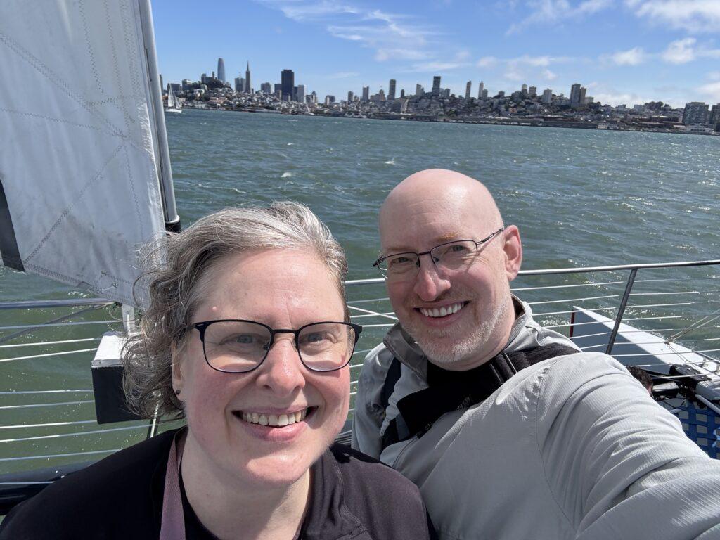
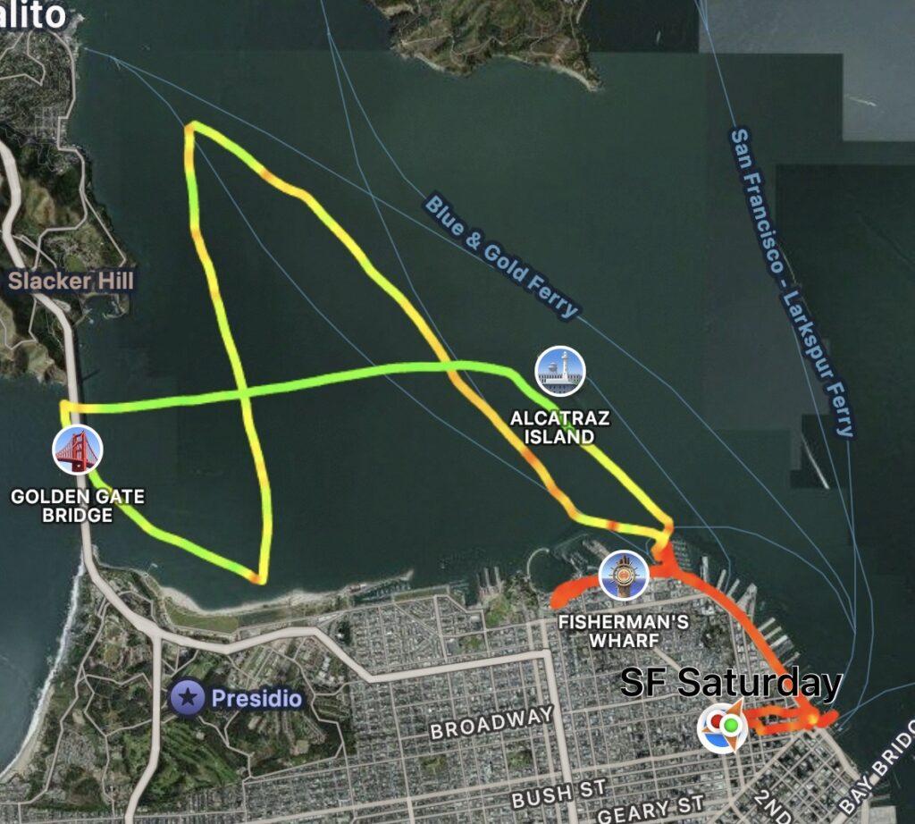
Grabbed lunch, then had an incredible catamaran sailing tour of the San Francisco Bay, including going under the Golden Gate Bridge. The weather was perfect the entire way, and we got some absolutely gorgeous views of San Francisco. We can highly recommend Adventure Cat Sailing if you get the chance.
When that finished, we continued our walk north along the Embarcadero, eventually making it all the way up to Victorian Park/the San Francisco Maritime National Historical Park. That was when we turned around…but not without a detour through Ghirardelli Square to pick up a little chocolate.
We walked all the way back down the Embarcadero to the ferry terminal where we’d started, and then back up to the hotel. By that point it was 7 p.m. and we’d been going pretty solidly since 9 a.m., so it was time to stop so we’d be ready for tomorrow.
Day 3: San Francisco
A little less walking today…but not by a lot, I still broke 18,000 steps and went almost 9 miles.

We had a fairly slow morning, eventually making our way up to the closest BART station and heading out to the Mission district. Once we were there, we got a small taco brunch using the “first open place we walk past” method, and it worked great.
From there, we headed up to the Mission San Francisco de Asis, and realized we could tour both the old (1776) mission and the “new” (1918) basilica. Both are gorgeous, and as it was Sunday morning, we were able to listen in to the choir at the end of one of the Sunday morning masses in the basilica.
After that we decided to head towards Golden Gate Park, started that way, and a ways along realized that we were about to cross Haight street. So, we turned and walked the rest of the way there along Haight street, enjoying all the old classic San Francisco homes and the many cute little shops and restaurants along the way, stopping in one for a lunchtime burrito, right through the Haight-Ashbury district until we hit the park.
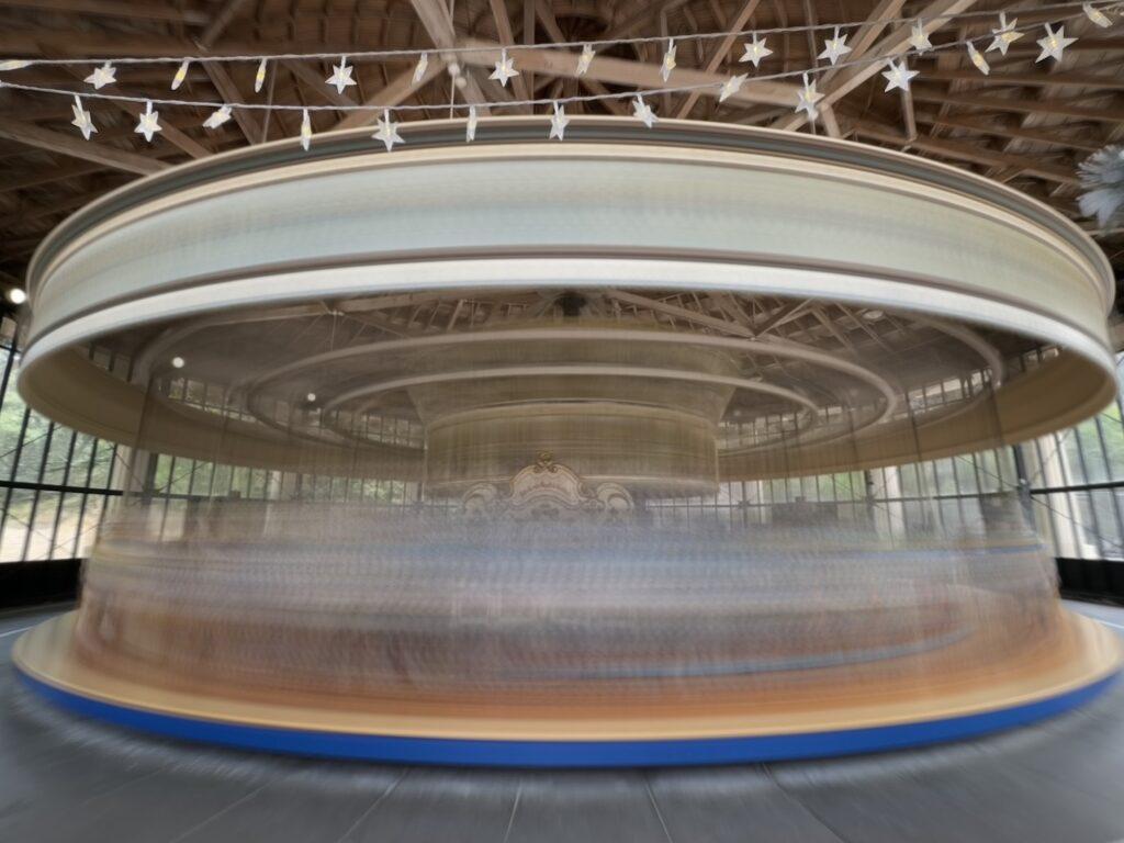
Once at the park, we ended up finding and riding the carousel, listening to a Hungarian folk trio and the Golden Gate Park Band as they celebrated St. Stephen’s Day, and then spending most of the rest of our time there slowly exploring the San Francisco Botanical Garden.
Eventually we could tell we were wearing down, so we headed out of the park. We found local burgers for dinner, hopped on a Muni train back towards downtown, and made it back to our hotel a little after six. Time to rest!

Day 4 (part 1): San Francisco to…?
This morning we kept nice and slow. Took our time waking up and getting mostly ready to go, then had a brief outing to get breakfast at a corner place we’d passed a few times that looked good (and it was). Back to the hotel for the final load out, then a quick ride on the BART to get to the airport.
Now we’re all checked in, through TSA, lunched, and kicked back at our gate, ready for the next part of our summer adventure….